Showing posts with label Colorado. Show all posts

21 April, 2025

R for Rocky Mountain National Park #BlogchatterA2Z

Rocky Mountain National Park, Colorado

I am biased towards Colorado State and anything in Colorado. So, I can only say positive and awesome things about places in Colorado. :-)


Rocky Mountain National Park is one of the most scenic national parks in North America, covering 415 square miles. If you love mountains, snow, scenic drives, alpine lakes, waterfalls, wildlife, and hiking, this park is for you.

It is famous for the Trail Ridge Road, a 48-mile stretch connecting Estes Park to Grand Lake. This climbs to an elevation of 14000 ft above sea level. This is one of the highest paved roads in North America.

There are many hikes to see alpine lakes and waterfalls in the park. Boating on Grand Lake is relaxing and peaceful. 

Here is our travelogue for Day 1 and Day 2.


Accommodations Near Rocky Mountain National Park:


Until next time,


Note: This post contains affiliate links. If you purchase through them, I may earn a small commission at no extra cost to you.

I'm participating in #BlogchatterA2Z


Other A2Z Posts:

A for Arches National Park

B for Bigbend National park

C for Capitol Reef National Park

D for Disney

E for Escalante National Monument

F for Fort Davis

G for Great Smoky Mountains National Park

H for Hot Springs National Park

I for Idaho Springs

J for Jackson Hole

K for Kasha Katuwe Tent Rocks National Monument

L for Las Vegas

M for Monument Valley

N for Niagara Falls

O for Orlando

P for Pikes Peak

Q for Quiet and Secluded

R for Rocky Mountain National Park

S for Santa Fe

T for Talimena Scenic Drive

U for Utah

V for Vermont

W for White Sands National Park

X for Xtreme Weather

Y for Yellowstone National Park

Z for Zion National Park

19 April, 2025

Q for Quiet and Secluded #BlogchatterA2Z

Quiet and Secluded 

Q is always a tricky letter to write about. I found a few places in the USA with Q that I haven't been to.

I want to write about places that I have experienced. So, here you go. 

We have driven through some remote parts of the USA which are quiet, and secluded without any civilization around. It is interesting and sometimes scary to drive through those roads in the dark.

Davis Mountains Scenic Loop: This 76-mile scenic drive is very remote in Texas. No civilization, no houses, no buildings, and just the rocks, trees, and mountains. We always wonder how they have well-built roads to such places even though very few people live there.


In the middle of nowhere


Monument Valley -> Four Corners Monument -> Mesa Verde National Park :

This drive goes through remote areas of Utah, New Mexico, and Colorado. Miles and miles of road to drive, but very few houses, gas stations, and even rest stops. We had to do it to cover those important places. 

White Sands National Park to Roswell :

This route goes through mountains and passes through Ruidoso which is remote, but a beautiful winding mountain road. No gas stations or rest areas on the route. Felt very secluded and quiet.

A Quiet Place on the Davis Mountains:

We haven't gone camping in a remote place yet. But, we experienced a very nice airbnb in the Davis Mountains. No cell coverage, beautiful Sunrise and Sunset views, designated dark sky place without any lights in the night, very good for star gazing. It is a beautiful and unique experience to enjoy the colors of the sky, listen to birds, watch wildlife and watch stars and galaxies in the night.


Unrestricted view of Sunrise from Airbnb


Have you ever experienced the Quietness of any place like that? 


Until next time,


I'm participating in #BlogchatterA2Z


Other A2Z Posts:

A for Arches National Park

B for Bigbend National park

C for Capitol Reef National Park

D for Disney

E for Escalante National Monument

F for Fort Davis

G for Great Smoky Mountains National Park

H for Hot Springs National Park

I for Idaho Springs

J for Jackson Hole

K for Kasha Katuwe Tent Rocks National Monument

L for Las Vegas

M for Monument Valley

N for Niagara Falls

O for Orlando

P for Pikes Peak

Q for Quiet and Secluded

R for Rocky Mountain National Park

S for Santa Fe

T for Talimena Scenic Drive

U for Utah

V for Vermont

W for White Sands National Park

X for Xtreme Weather

Y for Yellowstone National Park

Z for Zion National Park


18 April, 2025

P for Pikes Peak #BlogchatterA2Z

 Pikes Peak, Colorado 

Pikes Peak is one of the highest peaks in North America, at 14,000 ft above sea level. In comparison, the Leh, Ladakh route in India is at 11,500 ft.

The greatest thing about this peak is its accessibility. A 19-mile scenic drive takes you to the summit. Visitors can also reach the summit by train (Pikes Peak Cog Railway) or through a hop-on hop-off shuttle. 

The scenic drive might feel adventurous if you are not used to mountain driving.  The 360-degree views from the Summit are unbeatable.

These spectacular views inspired the author Katherine Lee Bates to write the iconic American Anthem " America - the Beautiful".

Here is our travelogue.

My Favourite scenic drive ever!


Until next time,


I'm participating in #BlogchatterA2Z

I give you one travel recommendation for each letter of the alphabet. So, follow my blog every day in April for travel recommendations.

I might post these on social media as well, here are the links if you want to follow me there..


10 April, 2025

I for Idaho Springs #BlogchatterA2Z

 Idaho Springs 

Many say, it's just a small town in Colorado. 

This town has many places to visit around:

Scenic drives: Guanella Pass , Mt. Evan's Scenic byway
Hiking : St.mary's Glacier
Boating: Lake Dillon
Waterfalls : Bridal veil falls
Gold Mine tours : Phoenix and Argo mill
White water rafting : Clear creek
Hot Springs and Geothermal caves : Indian hot springs
Scenic railroad: Georgetown loop during the fall season

Is this a must-visit now?

Here is our travelogue.

That's St Mary's Glacier!

St Mary's Glacier is a semi-permanent snow field. It is named as a glacier initially but changed to a snow field as it is stationary. It is a moderate 1.5-mile round-trip hike that is very popular. 


Until next time,


I'm participating in #BlogchatterA2Z


Other A2Z Posts:

A for Arches National Park

B for Bigbend National park

C for Capitol Reef National Park

D for Disney

E for Escalante National Monument

F for Fort Davis

G for Great Smoky Mountains National Park

H for Hot Springs National Park

I for Idaho Springs

J for Jackson Hole

K for Kasha Katuwe Tent Rocks National Monument

L for Las Vegas

M for Monument Valley

N for Niagara Falls

O for Orlando

P for Pikes Peak

Q for Quiet and Secluded

R for Rocky Mountain National Park

S for Santa Fe

T for Talimena Scenic Drive

U for Utah

V for Vermont

W for White Sands National Park

X for Xtreme Weather

Y for Yellowstone National Park

Z for Zion National Park


I give you one travel recommendation for each letter of the alphabet. So, follow my blog every day in April for travel recommendations.

I might post these on social media as well, here are the links if you want to follow me there..

18 March, 2021

Exploring Colorado National Monument with kids

 We visited Colorado National Monument which is near Grand Junction, Colorado in last winter. It was a trip during Covid and so we had to take a lot of precautions from selecting the clean place to stay, avoiding outside food, using sanitizer, reducing the use of public toilets, wearing masks during hikes, and blah blah. 

We chose Hilton hotels this time as well as we are comfortable and trust their safety procedures and cleaning. We took a suite and even cooked quick one-pot meals on an instant pot. Hilton provides a to-go breakfast which is manageable during covid. We wore masks for all hikes and used sanitizer for restroom breaks and carried Clorox wipes as well. 


Pin it for later!


If you ever visit Western Colorado, don't miss this gem- Grand Junction Colorado National Monument.


This 31 square miles national monument site boasts deep canyons, red rocks, sandstone towers, and a beautiful landscape.

As per the National Park service,

Colorado National Monument is a part of the Colorado Plateau which is a vast land of relatively horizontal rock layers situated between the Rocky Mountains and the Great Basin of Nevada. This land is deeply etched and dissected by the incredible canyons of the Colorado River and its tributaries.

Since we visited in the winter, there are very few visitors. Anyways, this is not the most populated park-like Arches and Rocky mountain national park. So, it's good to visit year-round.

The entrance fee is $20 per vehicle for a seven-day pass. 

What to do in Colorado National Monument?

You can bike/ hike and also cover a scenic drive. 

There are 2 entrances to the park -east and west. We entered through West Entrance,  which is more scenic than the other side.

The 23-mile Rimrock scenic drive is a must for anyone. The scenic drive has many overlooks which are accessible within a 1-mile walk. This seemed fantastic about the park when visiting with kids.

Our favorite overlooks on the drive are :

Red rock canyon overlook, 
fallen rock overlook, 
ute canyon overlook, 
highland view overlook, 
Balanced Rock at the west entrance near Fruita, 
book cliffs view(one of the best views) near west entrance,
 Independence monument view near the west entrance after Otto's trail, 
Grand view and
Coke ovens view

The first view of the park going up is this.


This has information about how the park formed due to an earthquake at the Redlands fault. Then, we pass through the tunnels.


Next, we get a glimpse of Balanced rock. There is a small trail to go near the rock.

Balanced Rock


Fruita Canyon View is our favorite view. Photos cannot make justice to the beauty of the canyon. 

Fruita Canyon View


The visitor center was not open due to Covid. 
Canyon rim trail from the visitor center is an easy 1-mile hike. We did this quick trail and it was a good introduction to the park.

The next family-friendly trail is the Window rock trail. It is a 0.5-mile round trip. Window rock is not very clearly visible until you bend from the overlook, but the view of the canyon is amazing.

Window Rock


Book Cliffs view near Window rock trail is one of the best views of the park. Canyon rim trail from visitor center connects to the book cliffs view. But, we can also reach that view through the window rock trail. Our kids enjoyed this trial.

Otto's trail an easy 0.7 mile out and back trail which gives a great view of the Independence monument. 

The Independence monument view is the main attraction. It is a 450-foot high sandstone tower. This was climbed by John Otto for the first time in 1911. He hoisted the American flag on June 11th to celebrate Flag day and from then, he made ascent every Independence day to hoist the American flag to celebrate Independence day.


Independence Monument


After stopping by the grand view, we hiked the coke ovens trail. These rocks which look like big ovens are unique to watch. It's an easy 0.9 mile out and back trail.

Coke ovens


If you observed, most of the trails so far are family-friendly hikes which we loved most about the park.

See, what we found on the road near the east entrance.


A few more trails that are worth hiking: Serpent trail and Devil's kitchen trail near East entrance. 


As the name suggests, the Serpent trail has 50 switchbacks in 2 miles. Isn't that amazing?

Devil's kitchen trail is 1.6 miles out and back trail that features a river as well. We couldn't do that due to lack of time.

Wrap up your day by driving back to Grand junction to relax. 
Some great restaurants around Grand Junction:
  • MI RANCHITO taco shop
  • ENSTROM candies
  • Fiesta gaudalajara 
  • El tapatio mexican
  • Alpine oven pie co
So, that's about exploring the Colorado National monument in one day with kids.  

Bonus Tip:

If you have one more day in Grand Junction, you can cover the Black Canyon of Gunnison, near Montrose. 

Have you ever visited this monument? Please share your experience in the comments. If not, do you love to visit? 

Until next time,


Pin it for later!


17 February, 2021

Crested Butte and Curecanti Recreational Area

 This post may contain affiliate links, clicking on those links may earn some commission to us without any additional cost to you.


This is part 3 of our Southwest Colorado trip. Check the below links to read the other parts:

Black Canyon of Gunnison

Telluride and Million Dollar Highway


Pin it for later!


On Day #4, on the way to Colorado Springs, we drove through the Curecanti Recreational area devouring the beauty of Gunnison river along the road, passing through the mountain town Crested Butte, covering a scenic dirt road drive to Kebler pass, and also driving through Cottonwood Pass.


Curecanti Recreational Area


On Day 1, when we traveled to the North rim of Black Canyon of Gunnison from the South rim Visitor center, we took the route through Montrose, Hotchkiss, and Crawford. But, there is another scenic route to reach the North rim, which passes through Curecanti Recreational area along the Gunnison River. This might take 30 mins more than the route that we took. But, if you have enough time, consider that route.


Curecanti Recreational Area


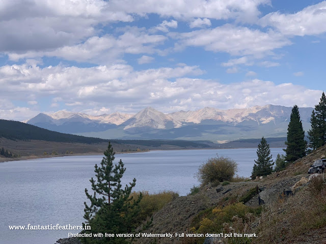
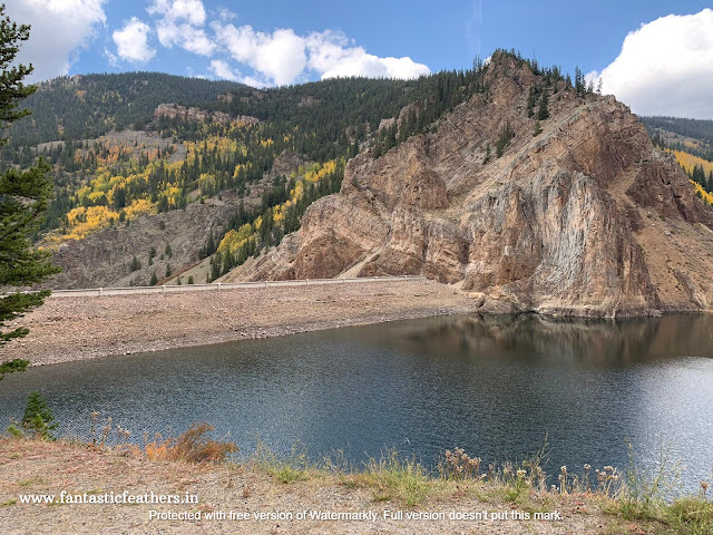
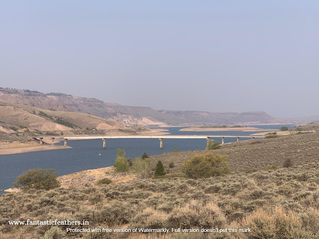
Anyways, while returning we saw a few places in Curecanti recreational area and I feel, this area is great for boating tours and a relaxing time on the river beach. 


Curecanti Recreational Area

Gunnison River
Curecanti Recreational Area


Curecanti Recreational area is a series of 3 reservoirs along the Gunnison River. The area is best for boating, hiking, and fishing. Morrow point boat tours is one of the highly recommended tours to cruise through the canyon. We missed it as we didn't have enough time.

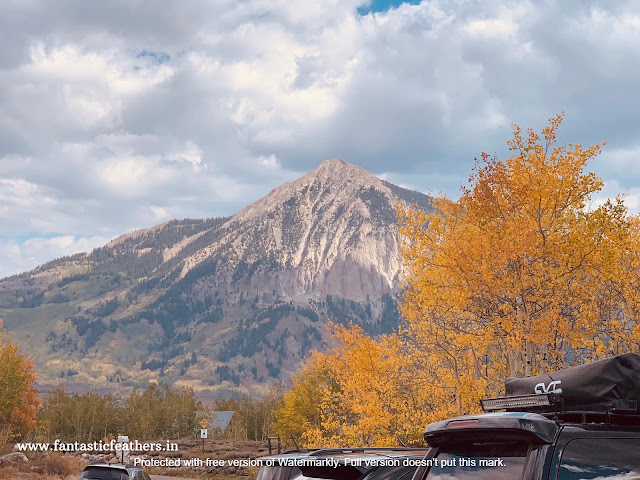
We stopped for lunch at Gunnison and started our drive to the scenic Crested Butte. Crested Butte is a mountain lover's paradise. A small town surrounded by beautiful mountains is a wonderful sight.


Crested Butte, Colorado
Crested Butte

Crested Butte, Colorado
Mt. Crested Butte


Crested Butte is popular as winter heaven. It is also called "Wildflower Capital of Colorado" and an excellent choice for mountain biking in summer. 

We drove through the dirt road to reach Kebler pass, which is around 30 mins from downtown. It was not as great as many passes that we saw in Colorado but, a pretty drive though. 


Kebler Pass
Kebler Pass

Kebler Pass
Kebler Pass


The leaves were just changing colors as it's the last week of September and it was a bit difficult to not stay in Crested Butte. But, a few things for some other time :-(

On the way to Colorado Springs, we drove through Cottonwood pass and this drive is always worth it. 

Cottonwood Pass reaches an elevation of around 12,100 ft above sea level and it goes from Almont to Buena Vista. The views are Instagram-worthy! 

We did the Continental divide hike and this is a great place to enjoy the views of the mountains and the curving roads below. A jacket is a must in any season except Summer. There are many beautiful alpine lakes to hike in this area and it is definitely a hidden gem of Colorado. 


Cottonwood Pass
Cottonwood Pass


We reached Colorado Springs by driving through our favorite route through Salida, Canon City, and Penrose. 

This wonderful trip etched beautiful memories in our life! Of course, we were a bit scared to travel during Covid, but thanks to Hilton in Montrose, which kept our rooms exceptionally clean and followed all safety guidelines. 

If you are looking for accommodation near Montrose, do check this map to book.


My Next travelogue will be about Colorado National Monument near Fruita. 

Until next time,


10 January, 2021

Million Dollar Highway and Telluride - A Travelogue

 This post may contain affiliate links, clicking on those links may earn some commission to us without any additional cost to you.


Here is the Day #3 itinerary of our Colorado SouthWest trip. We visited Black Canyon of Gunnison on Day#1 and #2. 


Due to Covid, we stayed in the same hotel in Montrose all 3 days to cover the places around. Hampton Inn Hotel in Montrose made sure that they followed all safety procedures for Covid. Rooms are exceptionally clean, contactless check-in available and they provided to-go complimentary breakfast as well. 

We started to Telluride from Montrose in the morning after breakfast. On the way, we made a quick stop at Dennis Weaver Memorial Park in Ridgeway. Just to see this Giant Eagle up close. This park also has river access, so you can get your feet wet and relax.


Dennis Weaver Memorial park, Ridgeway


We reached Telluride by afternoon. The drive was scenic. We took the free telluride Gondola and had lunch in the downtown area. 

Biking paths from Telluride Gondola


Bridal Veil Falls (the tallest falls in Colorado) is not far from downtown. We could see the falls and the powerhouse from the parking area but didn't have enough time to hike to the falls. This seemed to be a busy area with parking lots full. Someday, we would love to drive on the dirt road to reach Powerhouse on Jeep / 4 wheel drive. 


Bridal Veil Falls, Telluride


I am not sure what these 2 blue lakes are. Seems like they got color from some mineral deposits. But, they looked cool!


Telluride

Our next destination was Ouray. We had to skip Box Canyon falls on the way, as we thought we need at least 2 hrs time to explore the falls.

The US route 550 between Ouray to Silverton is known as Million Dollar Highway. It indeed gives million-dollar views!


Ouray

The highway got its name as someone in a planning meeting mentioned that it will cost million dollars to construct the road between Ouray and Silverton.

The scenic drive starts after the Ouray lookout point. The first stop is Bear Creek falls which can be viewed by the parking lot.

Bear Creek Falls


Later, the road goes through several switchbacks, narrow roads without guard rails with 360-degree views of majestic mountains and valleys.

Million Dollar Highway


The Switchbacks

The next stop is Hayden lake on the highway. A beautiful lake surrounded by mountains. Then, we drove through the red mountain pass.

Hayden lake


A few more views


We could capture a few more beautiful scenery before reaching Silverton. Trees were just turning yellow, it was around Sep 20th.


No Gaurd rails


The beautiful Yellows

We couldn't drive to Durango as we had to reach Montrose back by night and we don't want to risk driving the Million dollar highway without daylight.

But, If you plan a trip, stay in Telluride / Ouray so that you can explore the beautiful mountain town, Durango, as well.

By the way, While returning, we had a great Mexican meal at a local restaurant (GNAR Tacos) near Ridgeway. I highly recommend this restaurant if you love Mexican food.

Side Trip Ideas :

Even though we didn't have enough time to cover all places, I made a list of places and Side trip ideas. Hope, these are useful!

  • Telluride - Try Lost dollar road (4 wheel drive required ) and snap a picture of the mountain you see on Coors Beer bottle :-D This is also best to visit during the fall season to enjoy the fall colors.
  • Ouray - Visit Box canyon falls on the way, expect to spend 1-2 hrs.
  • Durango - If you can spend a day in Durango, catch the Durango to Silverton Narrow gauge train / hike the Animas river trail. A dip in Durango hot springs would be relaxing too. 
  • Silverton - Try the gold mine tour
On Day #4, while returning to Colorado Springs, we drove through Crested Butte and covered 2 more scenic drives. Those details will be in my next travelogue. Stay tuned.

Here is a map to book accommodation in Montrose:


Until then,

Stay safe.


Pin it for later!


Linking this to #MondayMusings hosted by Corinne at everydaygyaan


Related Posts Plugin for WordPress, Blogger...